Geosciences

SHN’s geosciences team is comprised of geologists, engineering geologists, and geotechnical engineers.

SHN geologists bring their sense of geologic time to contemporary problems.

SHN “emeritus” geologist Gary Simpson describes his work: “There is no stable. Mountains grow, become unstable, and fall. Seem-ingly solid ground shakes and becomes liquid. The sea sends tsunamis every few hundred years to drown forests and reconfigure the coastal landscape. In places like northern California and southern Oregon, we read this geologic story of the landscape and know it is all intimately tied together. The restless crust beneath our feet shapes the beautiful environment we call home; the loca-tions of mountains and rivers are controlled by faults, and the trees grow as the rocks and soil dictate.”
SHN geologists bring their sense of geologic time to contemporary problems such as finding safe and seismically stable locations for hospitals, schools, and other infrastructure (for example, roads and bridges, water treatment plants, pipelines). Their projects include landslide evaluations and stabilization design, fault hazard evaluations, resource and watershed studies, geohazard evaluations for power plants, dams, and hydroelectric facilities, and soils engineering assessments. They make complex geologic issues simple, and develop creative, effective solutions.

Geotechnical Investigation of Last Chance Grade, Del Norte County

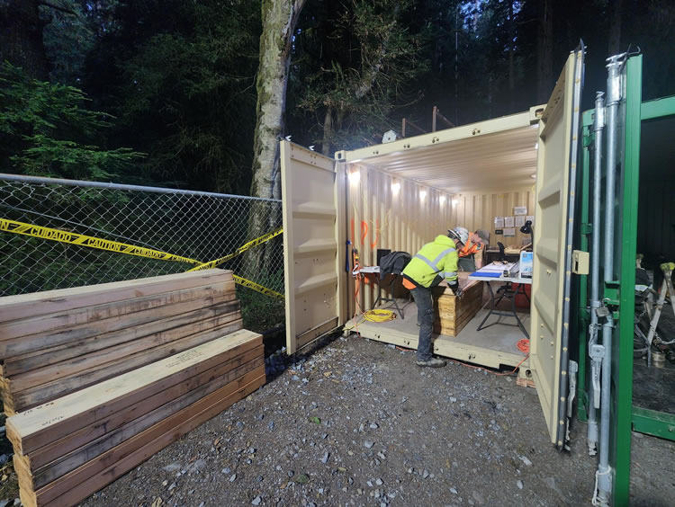
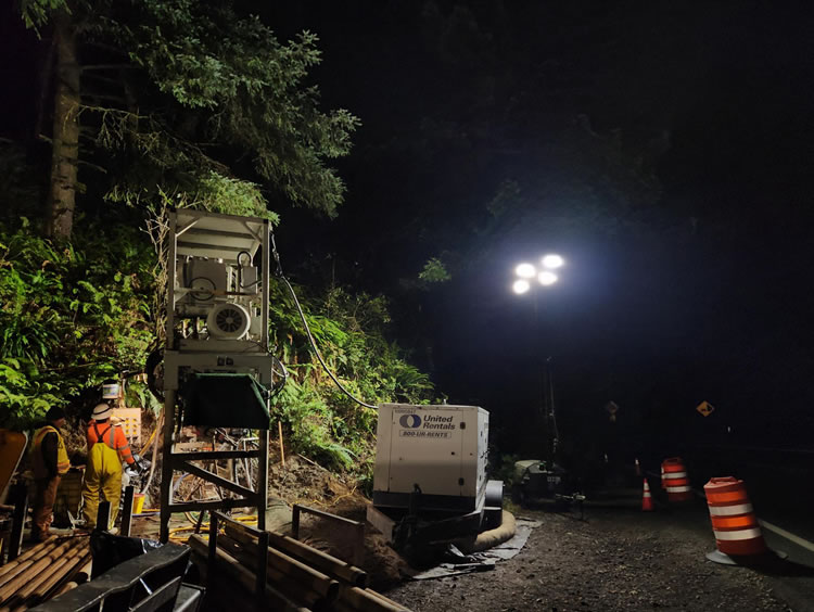
SHN geologists are playing an important role in the geotechnical investigation for the Last Chance Grade project, a technically complex and environmentally sensitive highway improvement initiative located on the rugged northern coast of California. This project addresses the instability and frequent roadway failures along a critical stretch of US Highway 101, which is prone to large active landslides and coastal erosion. The project involves constructing a 6,000-foot tunnel that minimizes impacts on the surrounding old-growth redwood forests. SHN’s geosciences team is collaborating closely with Caltrans and nationally and internationally known transportation consulting firms to ensure the project’s success, despite the challenging conditions posed by its remote location, extreme weather, and active earth movement.

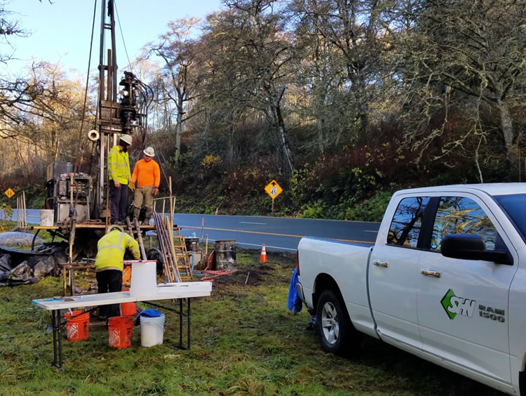
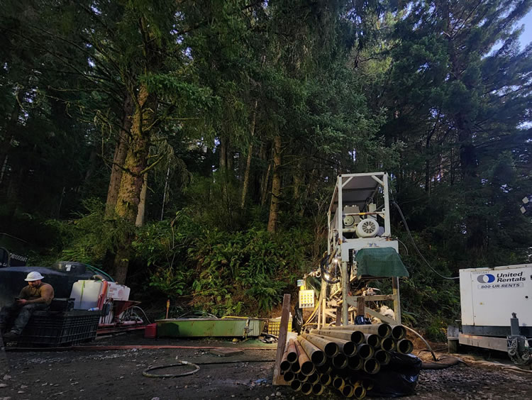
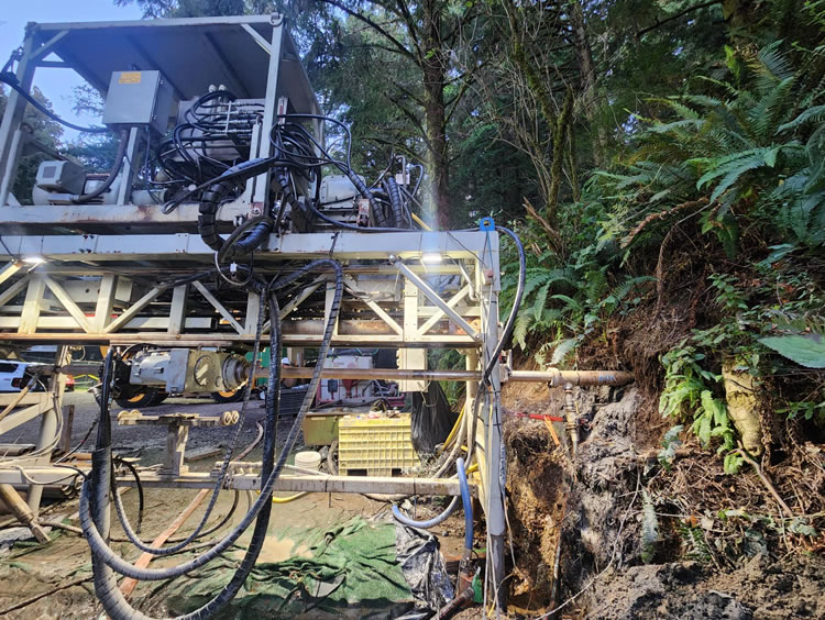
During the initial phase, SHN’s geotechnical investigations informed the alternatives analysis, which required us to assess multiple alternatives. SHN participated in geologic reconnaissance and mapping during preliminary landslide mapping and assisted with geotechnical logging of boreholes.  SHN provided logistical support for field investigations in remote and rugged terrain within old growth redwood forests, where stringent environmental protections apply. SHN staff’s expertise in the site geology and their ability to navigate the site complexities were instrumental in completing the field investigations during the initial phase.  SHN’s proximity to the site and knowledge of the local area is beneficial in supporting the project team during the planning and execution of field investigations.  SHN staff contributed to project reporting, focusing on the geologic setting and discussion of landslide processes.

SHN’s geosciences group continues to provide a unique service to the Last Chance Grade project, offering local knowledge and expertise that directly benefits, informs, and enhances the Project Team.  At its core, the Last Chance Grade project is about the site geology and our ability to inform the understanding of the site geology has proven to be a significant factor in completing successful field investigations.  Our ability to provide a geologic context to the complex site conditions allows a more thorough, informed basis from which to develop an appropriate project design.  We demonstrated our value and ability to complete geotechnical logging tasks, based on our familiarity with bedrock conditions in the project area.  SHN’s physical proximity to the project area benefits the Team and Caltrans because we provide efficient support for long duration field campaigns.

Project Details
  • Location: Highway 101 between Klamath and Crescent City, California
  • Owner/Client: Caltrans
  • Partners: Large design firms to whom SHN subcontracts
  • Project Timeline: 2020 to present

California Conservation Corps Residential Center

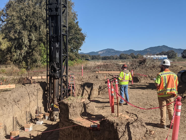
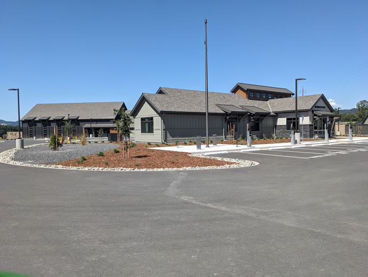
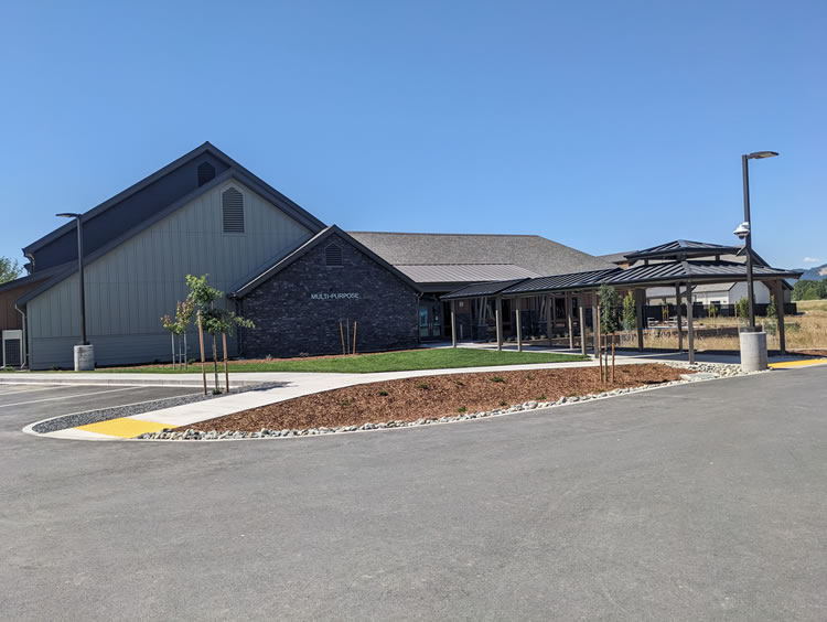
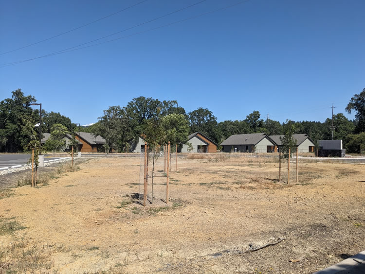
SHN provided multiple services allowing the architect to subcontract to fewer firms, making collaboration and communications easier and more efficient.  SHN assisted the architect and the California Department of General Services from 2018 to 2024, starting with topographic and boundary surveying of the undeveloped property, investigating the soil conditions and geotechnical constraints, assessing biological and wetland conditions, and ending with materials testing during construction. The project elevates and supports the California Conservation Corps, providing a 12-building campus for up to 120 Corps members.  Corps members respond to natural disasters, work on environmental projects, and are a valuable resource to our community.  

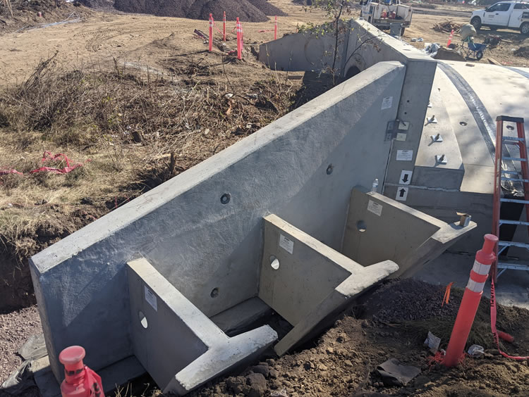
Technical challenges included the site’s liquefaction and settlement potential, which required engineered fill, placement of a soil reinforcement, and geotechnical design of buildings’ foundations and footings.  Constraints of development included an onsite wetland, high groundwater table, and grading within a flood plain.  A bridge was designed and constructed over a watercourse to allow for access to the north portion of the lot where a helicopter pad and solar panels were located.

Project Details
  • Location: Willits, California
  • Owner/Client: California Department of General Services
  • Partners: Nichols, Melburg & Rossetto Architects
  • Project Timeline: 2018 to 2024

Geologic Reconnaissance for the Proposed Great Redwood Trail, Eel River Canyon

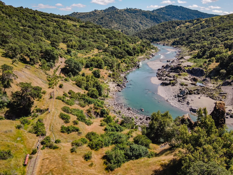
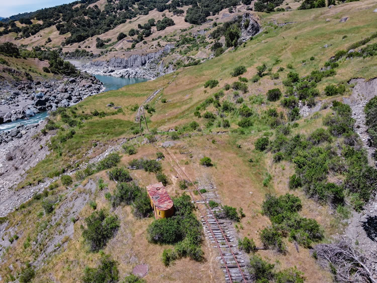
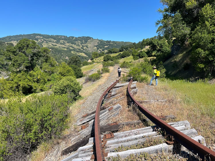
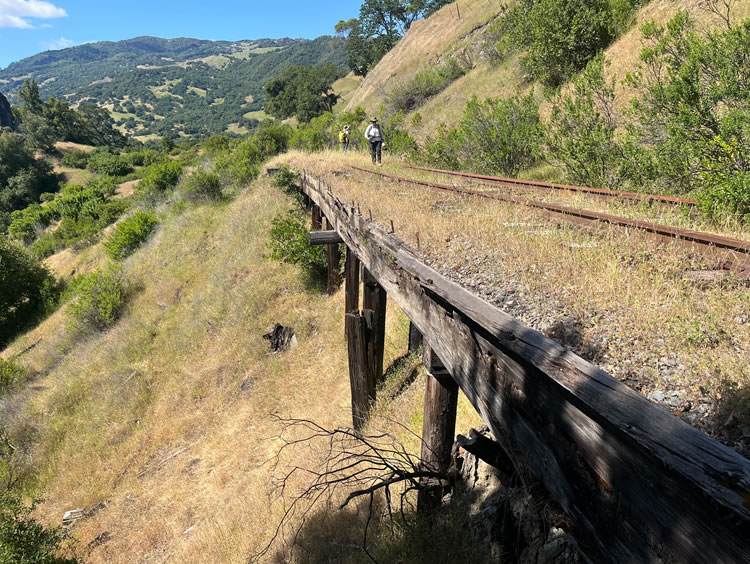
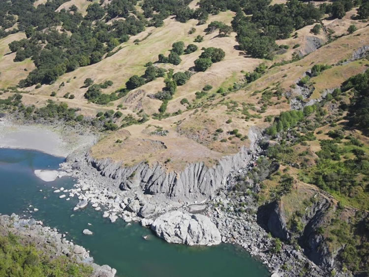
SHN geologists and engineering geologists performed a reconnaissance-level evaluation of a 10-mile segment of the proposed Great Redwood Trail (GRT).  The segment is within the Eel River canyon from Dos Rios to Rio Dell and is the most remote segment of the 312-mile GRT.  The GRT is planned to be constructed within the right-of-way of the former Northwestern Pacific Railroad, and when completed will be a multi-use recreational corridor from Sonoma to Humboldt County.  The project objectives included identifying geomorphic constraints and developing preliminary mitigation recommendations for the 10-mile segment.

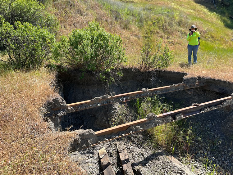
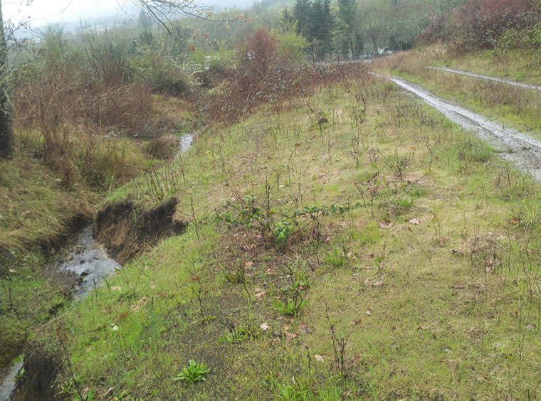
Three key constraints are: 1) Slope Instability.  The corridor is dominated by active earthflows, translational/rotational landslides, and debris slides. Earthflows often display ongoing movement, with lateral scarps, ponded water, and displaced rail infrastructure. Translational and rotational slides are common, and debris slides and rockfalls are prevalent where the trail is cut into steep, rocky canyon walls. 2) Adverse Drainage and Erosion. Damaged or undersized culverts, poorly drained areas, and uncontrolled surface flows have resulted in deeply incised gullies, undermined rail grades, and localized slope failures. Many culverts have failed due to slope movement. 3) Limited Access. Construction and maintenance are complicated by the remoteness of the corridor and restricted vehicle access. Many sections are only reachable by foot or small off-road vehicles, limiting the feasibility of heavy engineering interventions.

Each geologic constraint will require site-specific approaches but five general mitigation recommendations are:  1) realign and reroute the trail segments, where slope failures or deeply incised gullies make in-place trail construction impractical, 2) improve grading and drainage in areas with moderate instability, by regrading scarps and gullies to gentler slopes, installing rocked wet fords, and armoring channels, replacing damaged culverts with properly sized structures, 3) reuse material such as existing ballast, aggregate fill, and rock from the rail corridor for trail surfacing, embankment stabilization, and drainage features, 4) minimize engineered structures (e.g., retaining walls, debris catchment systems) and place them only where simpler measures are not feasible due to access or safety concerns, and 5) plan for ongoing maintenance and monitoring.

SHN’s engineering geologists will next be evaluating a 12-mile segment from Willits to Outlet Creek (approximately Covelo Road).  All of SHN’s service areas have contributed to portions of the Great Redwood Trail and we continue to assist the cities, counties, special districts, and non-governmental organizations that share the GRT vision.

Project Details
  • Location: Eel River Canyon, Mendocino and Humboldt Counties

  • Owner/Client: The Wildlands Conservancy

  • Partners: Great Redwood Trail Agency

  • Project Timeline: 2025

Geohazard assessment for municipal water supply in a seismically active region

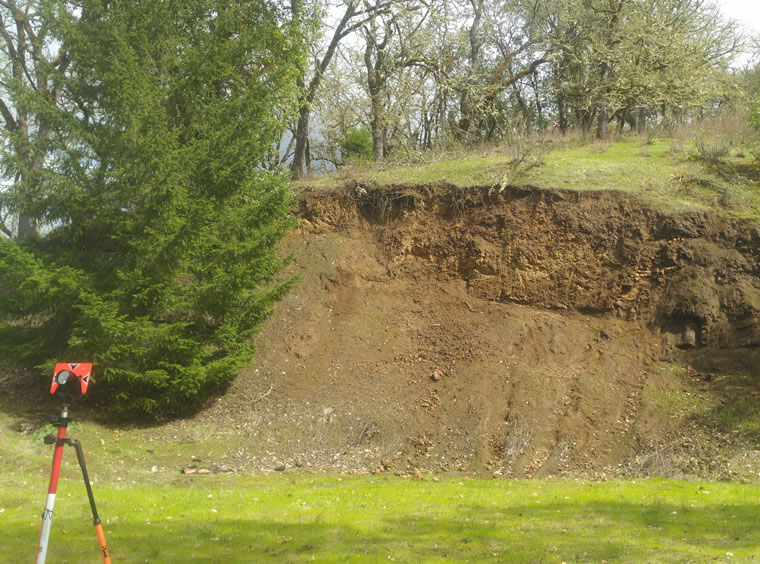
The Roberts Creek Water District (now part of the Green Area Water and Sanitary Authority) initiated the Water Storage Tank Replacement project at the Town Tank site in Roseburg, Oregon, to increase water storage capacity, improve fire flow, and ensure uninterrupted service for the local community. The project involves constructing a new 500,000-gallon water storage tank and associated water lines, on the site of old tank that had been removed. The new tank will be situated at the original tank location, east of Highway 99, on the western slope of a resistant bedrock ridge that descends toward the South Umpqua River. The site’s elevation and proximity to critical infrastructure make it an ideal location for supporting the district’s operational needs and future growth.

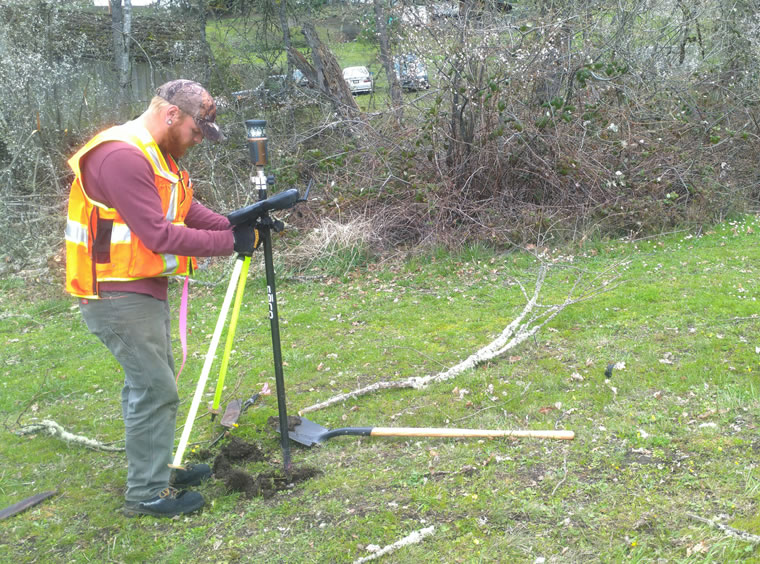
To support the design and construction of the new tank, SHN geologists and engineering geologists conducted a geotechnical investigation that included subsurface exploration, laboratory testing, engineering analysis, and the development of site-specific geotechnical recommendations. Six exploratory borings were drilled at strategic locations: three at the proposed tank site, two along the new water line alignment, and one at the tie-in area adjacent to Highway 99. Laboratory tests assessed the index and strength properties of the subsurface materials, including moisture content, dry density, Atterberg limits, and unconsolidated undrained triaxial strength. The investigation aimed to characterize the subsurface conditions, evaluate geologic hazards, and provide recommendations for foundation design, earthwork, and seismic considerations.

The site is located in a seismically active region, with the primary seismic hazard stemming from potential megathrust earthquakes along the Cascadia subduction zone, approximately 99 miles to the west. The risk of strong ground shaking during the design life of the tank is considered moderate. The potential for liquefaction is negligible due to the predominance of bedrock and stiff clay, though moderate hazard exists at the tie-in area.  Given the variability in subsurface conditions and the presence of undocumented fill, SHN provided detailed recommendations for foundation design and site preparation.

Project Details
  • Location: Roseburg, Oregon

  • Owner/Client: Roberts Creek Water District

  • Partners: NA

  • Project Timeline: 2019 to 2020

We specialize in civil, environmental, and geotechnical engineering; geosciences; planning and permitting; surveying and drones; environmental and biological sciences; and materials testing and special inspections.